
Borehole Geophysical Logging
A borehole geophysical log is the science of recording and analysing measurements of physical properties made in wells or test holes.
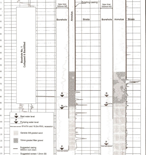
Borehole Geophysical logs provide a borehole record of the lithology, fractures, permeability, porosity and water quality.
Geophysical logs provide hard data on lithology and features and give the real indication of the underlying geology rather than visual assessment which is open to human error.
A sensor is lowered into the borehole that measures different physical properties that can then be interpreted against known records for an accurate record of the borehole and geology.
What are the benefits a Borehole Geophysical Log?
- Identifies the location of water bearing zones
- Assists in underground modelling
- Identifies the character and thickness of geologic materials
- The location and condition of casing and screen can be quickly determined
What is the end result of a Geophysical Log?
A borehole record and log is produced that forms a permanent record of the underlying strata allowing an engineer to make further assessments on the status of the geology, its characteristics and potential for the future.
Time and money can both be saved by the additional knowledge that borehole geophysical logging can provide.